Real Mountaineering
Before all of this Lymphoma stuff began, we had been meaning to do some backpacking this summer. Since I’m feeling pretty good and my surgery is soon, Jim and I decided to get away and at least do some day hiking. It was quite an amazing experience and we are both feeling truly thankful and blessed.
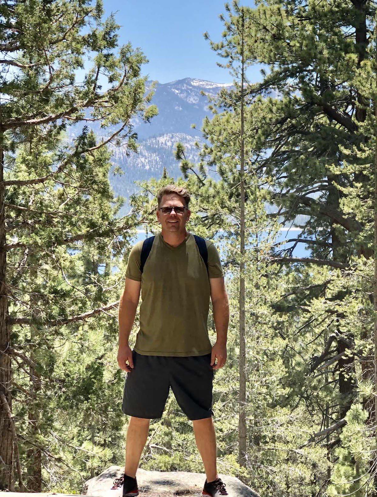
Our adventure began Thursday afternoon after Jim finished his final summer school stint for the year. We loaded up and drove over Kaiser Pass, headed for Lake Thomas A. Edison (Edison Lake) and the Vermillion Valley Resort (VVR). Jim had reserved a tent-type cabin called a Yurt at VVR for three nights which gave us two full days for hiking. For those who don’t know, Jim worked as a cook at VVR for the three summers prior to us meeting in college. It’s not only nostalgic for Jim, it’s one of the nicest places to get away to in the high Sierra.
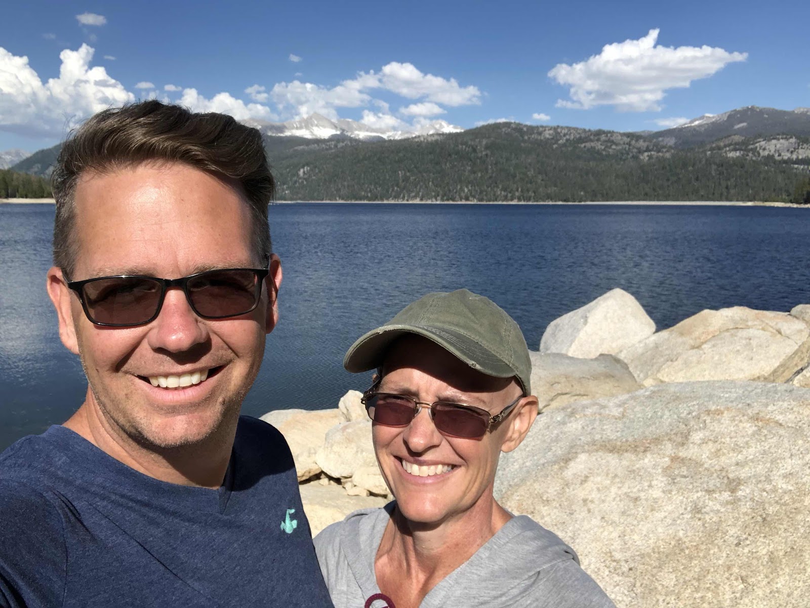

VVR is a great little resort. There’s a store, a restaurant, and they rent a variety of tent cabins, RVs, and the Yurt that we reserved. They cater to fishermen and hikers on both the Pacific Crest Trail (PCT) and the John Muir Trail (JMT). The hikers congregate there in the evenings for restocking food supplies, resting up after time on the trail, eating a hearty meal in the restaurant, and sharing trail news with one another.
While we definitely aren’t thru-trail hikers, Jim and I do both enjoy the outdoors, especially high in the Sierra. Coming to VVR gave us the opportunity to relax next to the lake with our morning coffee, do some hiking each day, and enjoy evenings around the campfire with the “serious” hikers.
We took our first hike of the weekend on Friday. After contemplating our day hike options, we chose the Goodale Pass trailhead which begins just above Edison Lake. The lake‘s elevation is 7,648 feet and the trail gradually climbs to Graveyard Meadows, Graveyard Lakes and beyond. When we set out, we intended to head to Arrowhead and Feather Lakes which are at approximately 10,000 feet. Unfortunately, the trail to those lakes was not clearly marked, the junction was nearly indiscernible from the main trail, and we missed it. We instead continued walking until reached Graveyard Meadows. The high creeks from the abundant snow melt stopped us from going further and we were already 5 miles out.
The hike was full of adventure. It’s very wet in the Sierras this year. The hikers call it a “snow year” because so much is still on the ground as well as melting and still filling the meadows and streams. That much moisture has created a Shangri La for mosquitoes. They are abundant and want everyone to know it. We made a silly mistake and didn’t take insect repellent with us on the trail. We were being eaten up within minutes of heading out!! Being the deep thinkers that we are, we decided there must be a homeopathic remedy for keeping these awful critters away. We spent quite some time picking leaves and needles from a variety of shrubs and trees as we walked, grinding them in our hands and rubbing the entire mess on our skin (we know to avoid poison oak in all instances though so it didn’t make the cut). Mostly, the efforts were futile, although if you ever find yourself in dire straights, manzanita rub worked a bit, so keep that in mind! It smells quite pleasant too. 😉
Mosquito invasions continued all day and we eventually just laughed them off as a learning experience: never hike without insect repellent.
We had an objective in mind, to reach the high country, so we pushed on, not letting a few thousand mosquitoes deter us! At one point, we reached a swiftly flowing creek. I looked at Jim thinking we would have to just turn back, but he said, “Oh no, we are going across!” I had never forded a creek that couldn’t be crossed by fallen logs or even by hopping from rock to rock before. This was going to be an adventure and a “first time” experience for me. I was a little surprised, and I unthinkingly asked “How?” That query led to a shared good laugh. I’m currently reading a book about hiking the PCT which was written by one of my favorite travelogue authors, Keith Foskett. Jim asked me, “What did he do to ford creeks in your book?” My reply, “I don’t know! He’s still in the desert in Southern California at the point I’m reading!” Thus the fit of laughter. Well, we both knew the actual answer. Take off your shoes and socks, use your trekking poles (we don’t have any so we used a large stick) for support, and make your way across the creek.
Did I mention that this creek was swiftly flowing? If you haven’t felt water flowing like that, it’s hard to imagine how much power it has. Instead of ending up across the creek from where one starts, you actually end up a bit of a way downstream because the water forces you to move with it as you cross. A bit frightening the first time, to be quite honest. Jim went ahead of me so that I could see it done before my own attempt. This didn’t bode well for my nerves as I watched him be pushed sideways by the current. His yelp when he entered the creek was also a precursor to my own experience. Not only was the water flowing fast and hard, it was COLD! Remember, this water was snow a few hours or days before it melted and flowed into the creek. The first step in was shocking, by the third or fourth, our legs were numb. Crazy! The current pushed, but we both stayed upright and made it across safely. The great thing was that the cold and chill left almost immediately after we reached dry land. ☺️. The other benefit was that I faced my fear and crossed that creek!

Once we were reshod, we once again headed uphill. We passed Graveyard Meadows and decided to continue onward to Graveyard Lakes. Unfortunately, we reached another creek! We had been told that a tree was down and we would be able use it to cross, but we couldn’t find it anywhere. We decided to turn back and not try to cross this creek. It was much more steep where it met the trail and seemed more dangerous than the one we crossed earlier. We decided not to risk it. This one wouldn’t have been very forgiving of even the slightest misstep. Instead, we decided to head back down, take a trail to Devil’s Bathtub and make a loop back to the trailhead where we had begun our hike. This route would remove the need for fording the original creek again. Unfortunately, this is a snow year, right? Lots of water hanging about. We had only hiked the new trail for about half a mile before we reached a large meadow that was completely filled with water. Our options were to slog our way through it, being attacked with every step by the mosquito hordes, or to return to the original trail. We went back, forded the creek again (it seemed so simple this time!) and made our way back to VVR.
This is going to sound like blatant bragging, and it is! I used an app called Strava to keep track of our progress as we hiked. It’s the same that I use to track cycling and jogging when I work out at home. When we finally got back to the trailhead Friday afternoon, we were pleasantly surprised and a bit shocked to check Strava and find that we had hiked 11.3 miles!! Although we didn’t make it to Graveyard Lakes, I think we did pretty darn well!!!
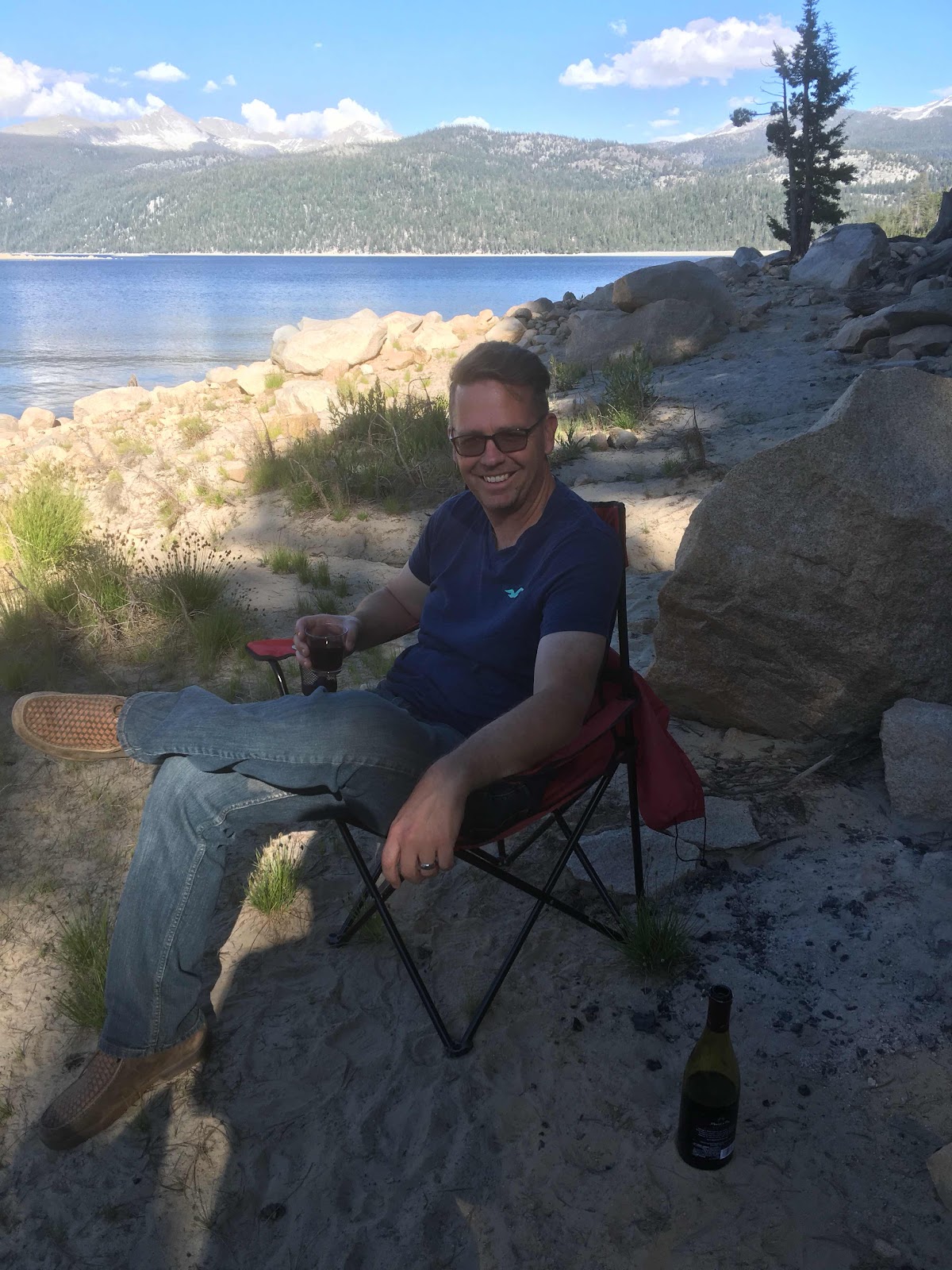
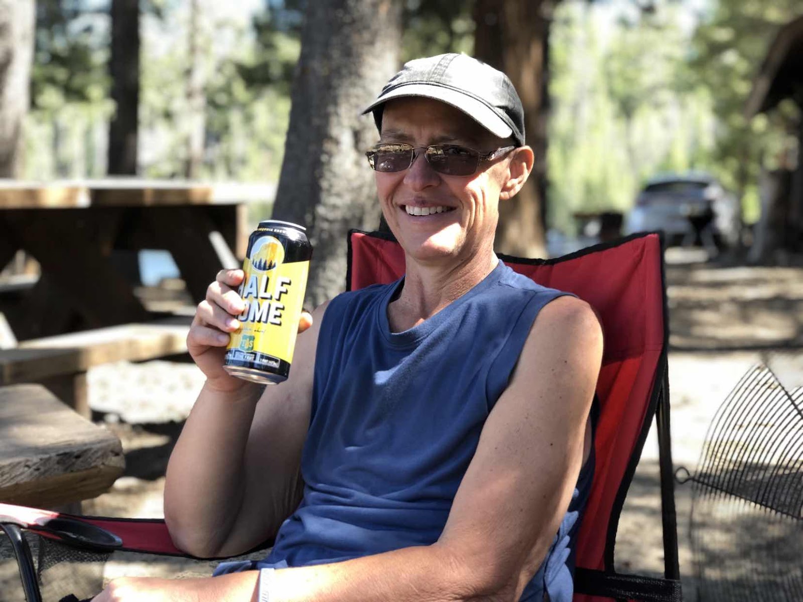
Once back at VVR, showered and refreshed, we enjoyed a beverage lakeside and then dinner at the restaurant. We rounded out the evening hanging out and chatting with a couple groups of PCT and JMT hikers.

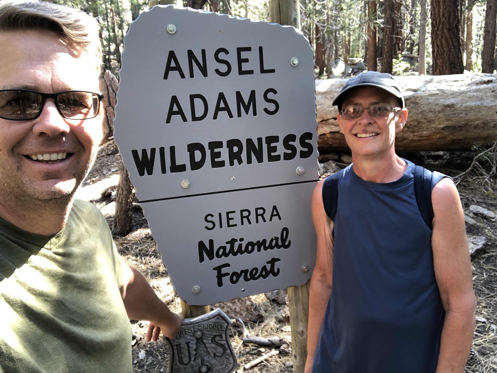
Our adventures continued the next day. We took the Onion Springs Jeep road for about five miles to the Arch Rock trailhead. This trailhead starts out at 8,200 feet and climbs to 10,400 feet in 4 miles. It then drops down over the ridge to Frog Lake and the Margaret Lakes. Our goal was to get to the top and at least look down on Frog Lake.
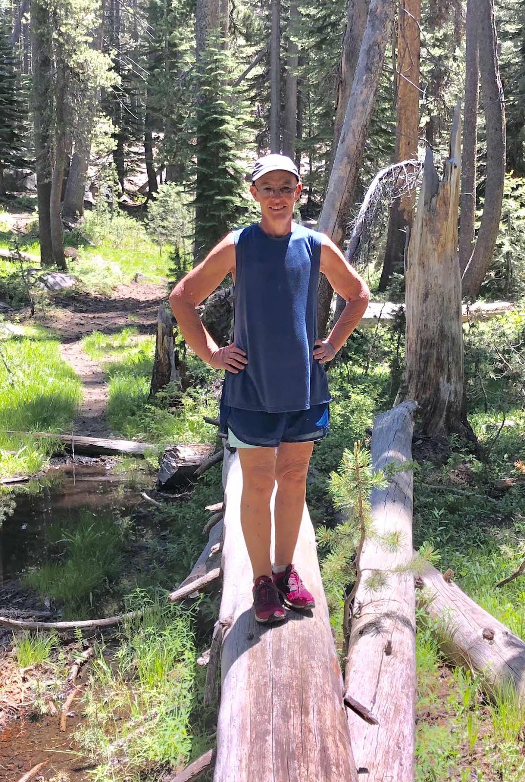
Once we reached the trailhead, we set off in pursuit of that lofty 10,000 foot goal. Within the first hundred yards of the trailhead, we encountered a nice, wet meadow. This day, we had anticipated the blood sucking hordes and shielded ourselves with plenty of insect repellent. What a relief: we passed the meadow and endured no swarms and no bites!!
The trail started out mostly flat but that quickly changed to a gentle slope. Before long, the trail was rising steadily. After about a mile of walking uphill, we hit the true mountain. The slope became so steep that the trail changed from a walk up the hill to a series of switchbacks meant to assist with the steep incline.


It was a beautiful hike. Each portion of trail offered distinctly unique views. The first mile wound upward through densely packed pines with a forest floor sprinkled with wildflowers and plenty of ferns and low growing shrubs in the shady areas. The hillside we crossed via switchbacks was covered in manzanita and other low-growing shrubs, some of which were blooming with a plethora of tiny off-white flowers. Quite stunning to see. As we left the final switchback behind, the trail entered a steep, narrow canyon filled with quaking aspen.
We emerged from the aspen onto a granite-strewn hillside. The trail rose gradually upward alongside a rather steep drop down to another canyon. At the top of the rise, it leveled out and ran along a ridge line for quite a ways. It was along this stretch of trail that we took our lunch break. We found shade under a beautiful old pine and sat down to enjoy a little picnic.
By this point, we were both pretty tired. The trail had taken us almost constantly uphill for 1,500 feet. That may not sound like much to those who haven’t spent time in high elevations before. The air is much thinner up there. That means that there is less oxygen available. Muscles being worked hard require a great deal of oxygen. It’s a catch-22: muscles that need extra oxygen in an environment that offers far less than you’re used to getting from each breath. The end result is that one tires out rather quicker than usual.
This was the make it or break it point for us. We were both tired. We could easily have turned back and headed downhill. However, we both wanted badly to reach our destination. For me, hiking at elevations above the tree line was a bucket list item. So, we forged on.
The trail wound around the east face of the hill where we had eaten. Aside from the trailhead area, those two hundred yards were the only level portion of our day. Once around the point, the trail dipped downward for a hundred feet, crossed a small creek, and again began a steady ascent of the hillside. It was about this point that we were able to look at the cliff face opposite our position and realize just how high we had already climbed. It was exciting to recognize the progress we were making.
Eventually, the mountain became too steep for a straight climb. We entered another series of switchbacks. Once again, we checked in with one another, making sure that we were both fully embracing the remainder of the hike. With every switchback conquered, we paused to catch our breath, check our upward progress as compared to the cliff face on the opposite ridge, and bolster one another’s efforts. Remember, this was a steep climb on top of already tired limbs. Our anthem became, “We are almost there!” even though we really weren’t sure just how much farther we actually had to go.
It was near the top of the switchbacks that I realized the forest around us had thinned out considerably. Looking ahead, I could see that we had almost reached the crest of our current hillside. I excitedly pointed this out to Jim who replied, “Let’s go. We’re almost there!” :)
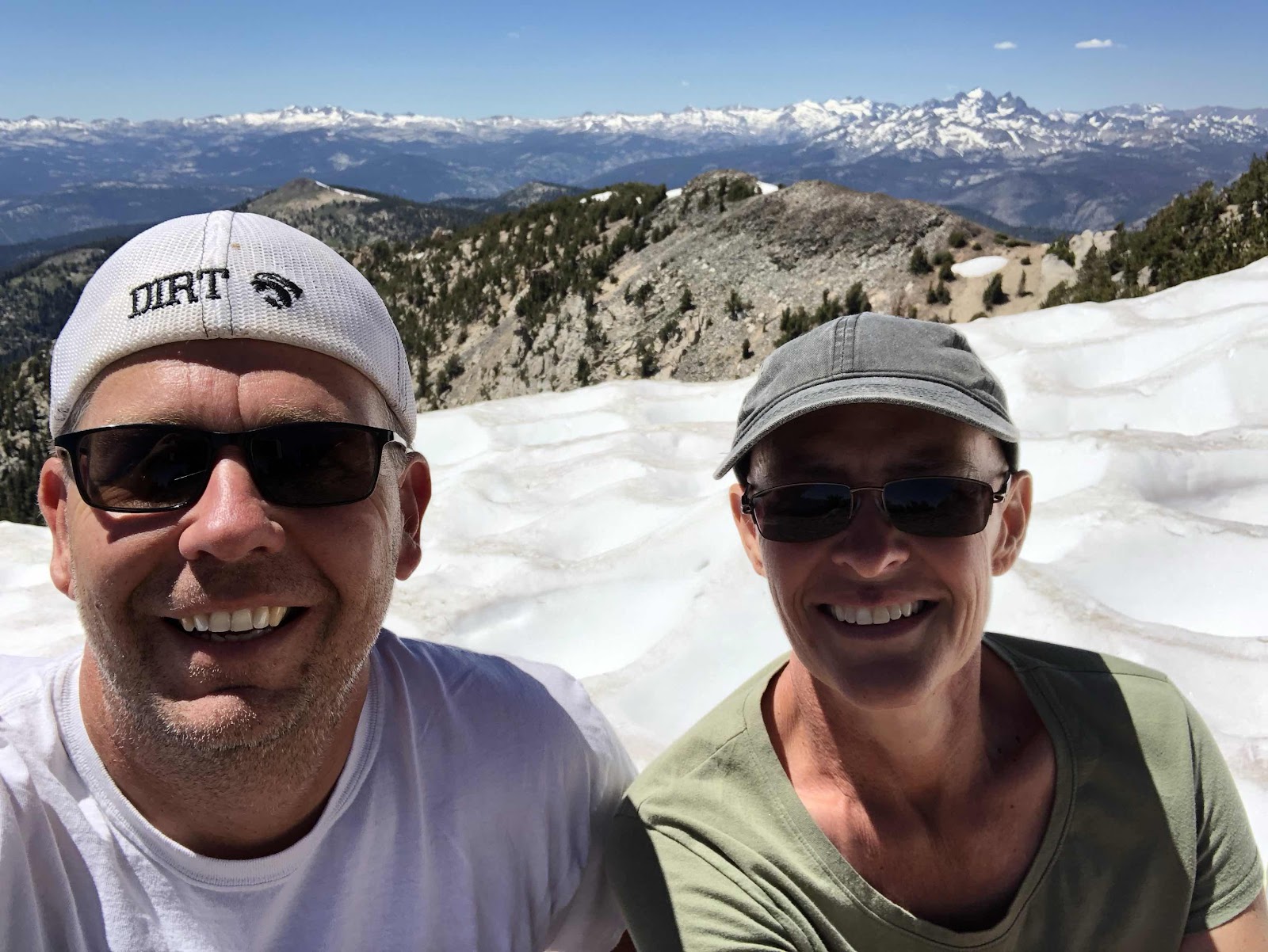
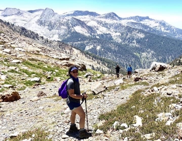
When we took those last few steps, we could see the final climb that awaited us. A barren rock face rose another 200 or so feet to a saddle between two peaks. We slowly made our way up and were greeted with an amazing view of the High Sierra to the north. The path ahead rose to the higher of the two peaks and was covered in snow.


We took a brief break at that point. While the path itself was covered in snow, the peak was not. We were within 200 yards of the peak and we weren’t going to let the snow deter us from our destination! We rested, rehydrated, and cautiously set out across the snowy expanse.


This was perhaps not our most wise choice of the day. The snow was icy and slick. It was riddled with sun cups which are concave points where the snow starts to melt and then freezes back over. They are quite dangerous because one often “breaks through” when stepping onto the surface of the sun cup. This can lead to a variety of injuries. At that point, we felt that we truly were mountaineering. We had to consciously choose each step, plant our feet and make sure they didn’t break through, take a few breaths to recover, and do it all again the next step. A misstep would have been disastrous because there was nothing to stop us from sliding down the entire hillside. It was mentally and physically challenging.
After making that crossing, the final hurdle was to clamber up the remaining hundred yards or so of hillside. This area was covered in scattered, loose rock. While it was a little unnerving to wonder if the rocks would shift or slide causing a fall, it was much easier to navigate than the snow had been. With a few pauses to catch our breath, we eventually emerged onto the peak. It was spectacular! The compass read 10,500 feet and we were privy to a 360 degree view of the surrounding magnificent mountains and valleys.
Standing on that peak, with icy wind blowing around us, and both of us smiling and thrilled by our success will forever be one of the most amazing moments of my life. I am blessed beyond imagining to have been able to experience it.

After taking some pictures and giving one another a congratulatory hug, we began our slow descent back to the trail. With the exception of slow going as we crept down that first rocky slope and back across the snow, we made great time. An ascent that took four hours was descended in less than two. A short drive back to VVR and we were ready to shower and enjoy a nice cold beverage to celebrate our amazing day!

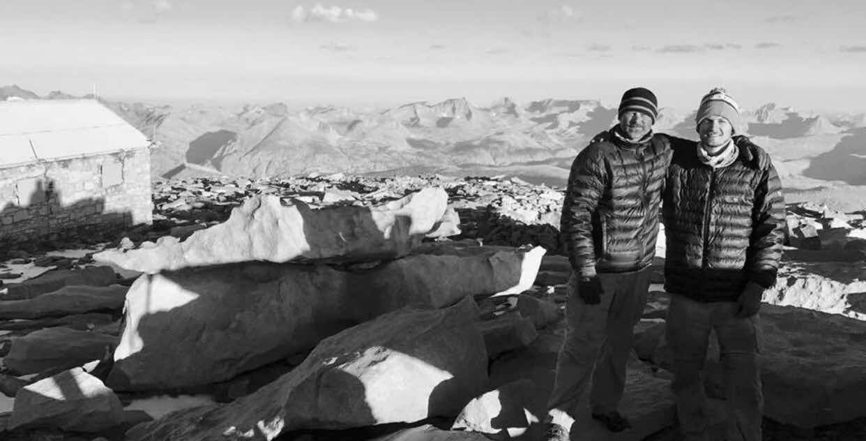
We ended up befriending a man and his son from Georgia just ending their JMT attempt. After the snow covered passes and tech malfunctions they decided to head home. We ended up driving them down from VVR to the airport in Fresno. It was a fun ending to an adventurous few days. Below is a pick of Ken and Wes on their adventure ... and then us dropping them at the airport.
We did get a call from Stanford on Friday. They left a message. Probably scheduling for surgery consult. We will call tomorrow and update when we know more.
Wow! I love your adventures, you two are amazing! I’m so glad you were able to get out in nature, I know it’s your happy place. Thank you for sharing, your writing is so much fun to read! Perhaps a book in your future??? Hugs my friend! 💜
ReplyDelete❤️
DeleteI felt as if I were with you on the hike. You have amazing writing skills. Kristi I am in awe over your strength & spirit of life. Continued Blessings & Prayers.
ReplyDelete❤️
DeleteAwesome story and very well written. Glad to hear you're out and about. Love you
ReplyDelete❤️
DeleteWhat a fabulous adventure! I love the back country.
ReplyDelete❤️
DeleteWow! That was amazing! I'm glad I can accomplish these adventures through you, lol love and miss you my friend.
ReplyDelete❤️
DeleteYou list me at "hordes of mosquitoes" love your writing. Sending love and prayers
ReplyDeleteLinda
❤️
DeleteWow, I think I'm sore from reading...my poor aching muscles!
ReplyDelete😂. Hopefully sore from the idea of the hikes and not from my rather lengthy writing! We are both pleased that we felt great after the hikes. We figured we would be sore, but we weren’t. I’m already dying to go back and conquer another trail!
Delete